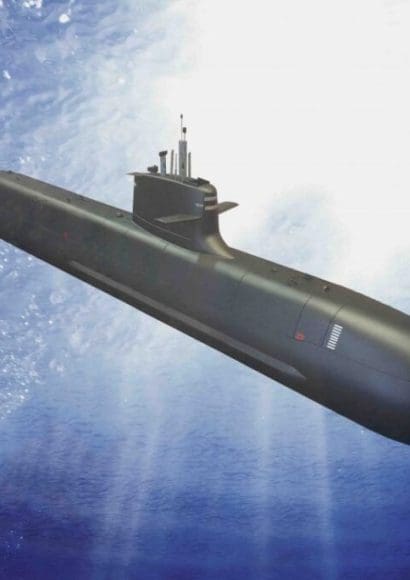
Submarine cartography has made impressive strides in recent decades, thanks to technological advances that allow for detailed exploration of what was once considered inaccessible. This science benefits not only the scientific community but also has applications in fields as diverse as geology, marine biology, and natural resource exploration. Advances in submarine cartography is a fascinating topic that continues to evolve at an astonishing pace. Below, I invite you to discover how these advances are redefining our understanding of the ocean.
Contents
History of Submarine Cartography🐟
The history of submarine cartography dates back thousands of years. However, for much of human history, the oceans remained mysterious and unknown. As civilizations began to navigate, the need for more accurate maritime maps became evident. But it wasn’t until the 20th century that technology allowed for significant advances in ocean floor exploration.
Early Attempts: Lead Lines and Echo Sounders
Before the advent of modern technologies, submarine cartographers relied on rudimentary techniques such as lead lines, where a weight was dropped from a boat until it touched the ocean floor. While this technique provided an estimated depth, the data was limited, and the process slow and tedious.
It wasn’t until the invention of the echo sounder in the 1920s that a significant leap occurred. This device uses sound waves to measure depth and allowed for faster and more precise exploration of the ocean floor. However, the resolution was still limited.
What technologies are used in submarine cartography?
In submarine cartography, the main technologies used include satellite altimetry, which measures sea surface height variations to infer underwater topography, and multibeam sonar, which sends sound waves to map the ocean floor in high resolution. Additionally, Autonomous Underwater Vehicles (AUVs) equipped with sonar and cameras explore deep ocean areas, and GPS technology aids in positioning. Seismic reflection is also used to study subsurface layers for geological mapping. These technologies together allow for detailed, accurate ocean mapping.
Technological Advances in the 21st Century🐟
With the turn of the century, submarine cartography experienced a true revolution thanks to advances in sensor technology, satellites, and underwater robotics. These advances have allowed scientists to explore remote areas of the ocean with unprecedented precision.
Satellite Cartography
One of the most significant innovations has been satellite cartography. While satellites can’t “see” the ocean floor directly, they use radar technology to measure variations in sea level. These variations reflect the underwater topography, providing a general image of underwater mountains, canyons, and trenches. Thanks to this method, more than 80% of the ocean has been mapped on a large scale.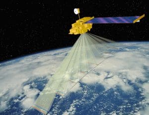
Autonomous Underwater Vehicles (AUV)
Another groundbreaking advance has been the use of Autonomous Underwater Vehicles (AUVs). These submersible robots can operate without being connected to a ship, allowing them to efficiently explore deep areas. Equipped with high-resolution sonar and cameras, AUVs can generate detailed maps of the ocean floor, detect submerged objects, and monitor underwater ecosystems.
Additionally, the integration of artificial intelligence into AUVs has optimized their exploration routes, increasing the efficiency and precision of data collection.
Applications of Submarine Cartography🐟
The advances in submarine cartography have not only improved our understanding of the ocean floor but also had a profound impact on various areas of society.
Natural Resource Exploration
One of the greatest beneficiaries of submarine cartography has been the natural resource exploration industry. The ocean floor holds vast reserves of oil, gas, and minerals. Thanks to detailed maps of the marine subsurface, companies can identify resource-rich areas and plan extraction activities more efficiently and with less environmental impact.
Protection of Marine Ecosystems
Advances in submarine cartography have also been crucial for the protection of marine ecosystems. By accurately mapping sensitive areas such as coral reefs, seamounts, and abyssal trenches, scientists can identify endangered species and propose more effective conservation measures. Additionally, these maps allow for monitoring changes in marine ecosystems over time, facilitating early detection of damage or alterations caused by climate change.
How much of the ocean has been mapped so far?
As of now, only about 20% of the ocean floor has been mapped in high resolution. While satellite technology has provided broader, low-resolution maps for over 80% of the ocean, detailed mapping using sonar and other tools remains limited to a smaller portion. Efforts like the Seabed 2030 project aim to map the entire ocean floor by 2030
Another field that has seen great benefits is maritime navigation and safety. Detailed underwater maps help avoid collisions with submerged formations, improve navigation routes, and enhance the safety of offshore operations. Especially in the transportation of large loads and military navigation, having accurate maps of the ocean floor is crucial to avoiding accidents and ensuring the safety of crews.
Challenges and Future Advances🐟
Despite significant advances, many challenges remain in submarine cartography. The ocean is vast and deep, and although enormous progress has been made, only a small part of the ocean floor has been mapped in high resolution.
If you’re a seafood enthusiast, don’t miss our 5 Exquisite Recipes with Alfonsino Fish That Will Elevate Your Culinary Skills for your next gourmet dish.
Exploration of the Deepest Zones
The deepest areas of the ocean, such as abyssal trenches, remain largely unexplored due to the extreme conditions they present. The pressure and darkness at these depths make the use of traditional technology difficult. However, new materials and technologies are being developed to withstand these conditions, which will enable more exhaustive exploration in the near future.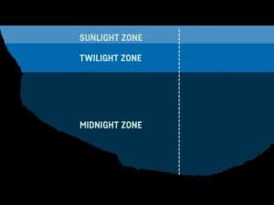
International Collaboration
Another important challenge is international collaboration. The oceans are a global resource, and mapping their entirety requires a coordinated effort between multiple countries. Initiatives like the Seabed 2030 project, which aims to map the entire ocean floor by 2030, are a step in the right direction, but much work remains to be done.
Interested in learning more? Check out Curiosities about Fishing with Rod to discover fascinating facts and tips for your next fishing trip.
The Future of Submarine Cartography🐟
As technology continues to advance, it is exciting to imagine what new discoveries await us in the future. The combination of artificial intelligence, advanced satellite technology, and underwater robotics promises to continue revolutionizing this field. Moreover, growing awareness of the importance of oceans to the planet’s health will drive more investment in ocean floor exploration and mapping.
Impact on Scientific Research
Advances in submarine cartography will not only help improve resource exploration but will also have a crucial impact on scientific research. Scientists will be able to study in greater detail the geological formations of the ocean floor, which could shed light on phenomena such as submarine earthquakes and the formation of new lands.
Additionally, the possibility of mapping areas that have never been explored before will open the door to new discoveries in marine biology, with the potential to discover new species and ecosystems never before seen.


